I recently discovered that this "new" Belknap Range trail is less than 10 minutes away from my college. Ever since then, I've kind of had it in my head that I should hike it after class some day. It's a new requirement on the redlining list, so I had to get it sooner or later, and I've seen a bunch of posts on the Belknap hiking group from people who did it and enjoyed it. Plus the semester is ending soon, so my window of "why not since I'm so close?" is closing, at least until fall. Till then I'll have to drive a half hour from home to reach this side of the Belks. So I had a lot of reasons to hike here now. More importantly, after a string of dreary weather, the skies cleared and it turned out to be a perfect afternoon for outdoor activities, and I really needed some nature therapy.
Unfortunately, Hummingbird was still caught up in work and other obligations, so she wasn't able to hike with me this time. This was another reason I chose a Gilford trail rather than Alton. Because, again, I was right there, and honestly I wanted something different. Iron Mine did not disappoint.
I'm not usually one to solo hike, but I was reminded of how much I actually enjoy it! It was quite lovely being out in nature, peaceful in solitude on this beautiful day, with the loudest noise being that of a pair of owls hooting back and forth. I was also able to stop as often as I wanted, for as long as I wanted, to snap photos, take in my surroundings, text someone to keep them informed of my progress, or simply rest and breathe without feeling like I was holding anyone back. I definitely did a lot of that on this trail! It was a workout!
Iron Mine trail is not on AllTrails, so stats are harder to come by. The Belknap Range website might list approximate mileage (tsk tsk, I didn't check before going), but I heard mixed reviews on its difficulty level. Obviously difficulty is relative to who you're asking, but it's nice to have at least an idea of what you're in for. I got the impression that there would be some steep spots, but it was overall moderate, and fairly short. My memory had it at around a mile or two, so I figured it'd be a quick(ish) hike. I was somewhat wrong. Ok, very wrong. But at least it didn't turn into an "overambitious" hike. Just… semi-ambitious.
 |
| trailhead & kiosk |
 |
| cool tree stump |
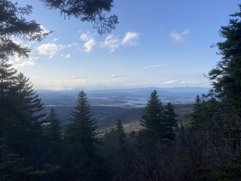
Right off the bat the trail climbs. And keeps climbing. There is no warmup; just immediate ascent. It is somewhat moderate, but unrelenting. This kind of hike can be kind of tough. But it's certainly good exercise! And the Iron Mine trail itself was quite enjoyable. It was in good condition overall, nice and wide, and surrounded by attractive forest. About half a mile up, you hit the ledges. I'd say this is the prettiest viewpoint on the loop. I would definitely hike it again to that point. The rest was less appealing as a repeat/regular hike option, though.
 |
| panoramic views from the ledges |
 |
| hmm, a camping/fire pit in the middle of the trail doesn't seem right |
After the ledges, the trail continues to be interesting and decent quality, but apparently less traveled, as evidenced by a couple cobwebs I ran into. Oh yay, spiderweb season. I also found the steeper spots, but they were a fun challenge, if even more of a workout.
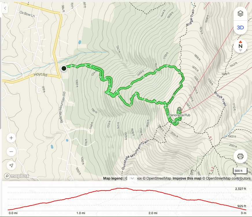
Eventually the trail splits. I considered for a moment if I wanted to go up the "easier" side after all I'd already done, but I stuck to my plan of continuing up the Iron Mine side and looping back down on Marge's Trail. Quick backstory: there once was an iron mining operation here on the side of Gunstock Mountain. It's said the iron was of the utmost quality. You will find a couple historic sites along the trail with signs explaining the history of the iron mines. (I do not, however, know who Marge is.) The Belknaps have some neat stuff! Anyway, after a mile or so, Iron Mine trail hits the BRT (the white-blazed ridge trail that runs the length of the Belknap range). From there you turn left to make your way towards Marge's trail to loop down, or you can take a right for a "quick" detour to peakbag Gunstock. I chose to do the latter.
 |
| oh no, ice on trail and I didn't bring my spikes! LOL |
 |
| cute viewpoint on trail heading to Gunstock |
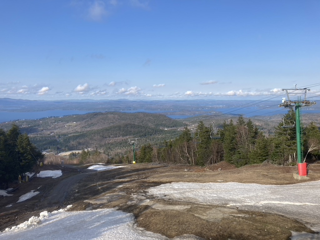
The BRT was not in great condition. It was very mucky after all the recent rain, and possibly still recovering from snow runoff. I actually spotted a patch of snow still lingering in the woods! Of course the ski trails still have a bit of snow too, but that doesn't count. I ran into several mountain bikers on the BRT, and later wondered if that was part of the reason it was so mucky. Wheels tend to tear up hiking trails, unfortunately. Of course, it takes frequent traffic to do that, and just heavy foot traffic on popular hiking trails can do the same. So who knows? At the time I only thought it was nice to see friendly people and chat for a moment. Plus I always appreciate anyone enjoying outdoor physical activities.
But before I met anyone, I continued my undisturbed hike to the summit of Gunstock. It was only about .2 miles from the Iron Mine junction (which is viewless), and I knew I'd kick myself if I didn't tag it and find out I didn't have it for April. I had looked at my Grid chart just the other day, but I couldn't remember for sure if I had hiked Gunstock "this month" in the past or not, so just to be safe, I got it. Of course it turns out I did have it already. But oh well, even though it probably added close to a half mile to my already longer than expected hike, it was nice. (And yeah, I guess I'm officially going for The Grid. Not actively - yet - but as opportunities present. Plus a patch is available now and it's really pretty! I'll add a link to the patches page here on my blog.)
It sort of looked like there might be a shortcut from the Gunstock summit over to Marge's trail, but I couldn't find it, and didn't dare get lost alone. Evening was closing in, and I was only packed for a quickie hike. Plus my phone battery was getting low. So I wisely chose to backtrack the way I came. The section of BRT between Iron Mine and Marge's Trail was a bit longer than expected (the theme of this hike) and continued to be in relatively poor condition in many places. However, aside from the muck, it's a pleasant trail.
 |
| viewpoint along the BRT |
 |
| Marge's Trail junction |
Finally I found the junction for Marge's Trail. It was nothing like Iron Mine. It was tight and brushy to begin with, and had several stream crossings and muddy spots. I was a bit concerned about ticks on the upper part, but I didn't pick any up. At one point, I slipped on a mucky rock or something near one of the streams and half fell. I caught myself with my wrist, which did not help my carpal tunnel. Thankfully I was ok otherwise. Later on the trail opened up more and had better conditions. On the other hand, it also turned slightly upwards around that point, which is always annoying when you're making your way down from a hike. But it wasn't bad. Once Marge's Trail meets back up with Iron Mine, you continue down the lovely main trail on which you began. It's still steep enough that it's not an entirely gradual decent; it could be a mild challenge to bad knees, but it was nice to be in the home stretch.
 |
| viewpoint on Marge's Trail |
All in all, I think this was a good hike, certainly a good workout, and I know I will repeat the whole thing with Hummingbird so she can check it off her redlining list too. (She texted me on trail that I better be excited to do it again with her soon! At the time I was, as I hadn't hit the worst parts yet. LOL) It was definitely slightly longer than I anticipated, since I thought I was going for a fairly quick hike, although I obviously tacked a bit on to my total distance by tagging Gunstock. But totaling just a little over 3 miles is certainly not long, so by no means is it a full day hike. It's just the elevation that might get you, as the trail climbs a lot in a relatively short distance. (This is the 3rd time I've hit over 1000 feet this year.) And while Iron Mine is not yet on AllTrails, everything is well marked, and the trailhead kiosk has a good map you can take a picture of. The trailhead itself is also on Google maps, so parking is fairly easy to find. I will note that it looks like a driveway, and is in a residential area, so I was a bit unsure until I spotted the kiosk in the distance. There is space in the well-made parking lot for at least a handful of cars. It's not plowed in winter, so access is only seasonal.
Go check it out! Whether you're Belknap redlining, or just like hiking new places, Iron Mine is worth exploring.
4/26 Iron Mine loop + Gunstock, 3.32 mi, 1260 ft, 1:55 hrs


No comments:
Post a Comment