The trouble with celebrating an anniversary on Memorial Day weekend is that, typically, no matter where you go, you’re fighting traffic and crowds and all the insanity that goes along with all that. But not this year. Instead, we spent it fighting heat and black flies and mosquitoes, hiking for miles through remote wilderness. Sounds like an anniversary that could become tradition. 😂
We had talked about several different options for how to spend the long weekend, including certain popular tourist destinations around New England. Hawk likes to do something special each year for our anniversary, preferably a nice trip. But during one discussion (incidentally while hiking), we talked about all our goals for the year, and Hawk brought up the waterfall trail he wanted to take me to. I suggested perhaps that would be a practical choice for this trip, considering all of the above, as well as finances. It started as just a spark of an idea, but we soon agreed that it made total sense. And so we aimed for the complete opposite direction of most vacationers.
We drove up to Monson, Maine on Saturday afternoon to the famous (amongst AT hikers) Shaw’s Hiker Hostel. Hawk has been there several times, and I stayed with them last year when dropping him off for a section hike. Accommodations are simple, as hostels are, but it’s affordable and full of good people. Hawk always enjoys spending time there.
On Sunday morning, after our night at Shaw’s, we headed out for another long drive deeper into the Hundred Mile Wilderness. Our end point was Hagas Gulf, which has a reputation for being a pretty amazing hike with multiple waterfalls. It did not disappoint! (I can't post all 69 photos [!!] that I have here, but I will share some highlights.)
We took the “back way” in, approaching from the west via the newer trailhead, since the main trail in from the east requires fording a river. So, yeah, I’m all for avoiding that. The newer access has several bridges, which we were happy to see.
 |
One of many bog bridges. There were regular bridges too. Amazingly, Hawk made no comments about them being over troubled water.
|
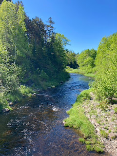 |
Plenty of water around. Though ironically, we were only able to access it to refill our water supply at a single point, far down the trail, which stays well above most of the river once you get some distance and are apt to need a refill. Herein may lie the benefit of going in the traditional direction, opposite what we did.
|
Another welcome sight at the beginning was privies. I'm always excited when I don't have to try to pee in the woods (never mind anything else, 'cause that's definitely not happening!) However, I was somewhat less excited when I used the privy… it was infested with flies! Hawk says "welcome to backwoods privies!" It was pretty disturbing, but I made it work. It was free of large spiders and bees, which were my main concern, so a freaky amount of plain old house flies tickling my backside 😝😝 is still slightly better - to me - than not having the option to sit on some sort of toilet. It was going to be a long day, so it was appreciated despite the extreme ick factor.
Unfortunately, that was not the last of our encounters with bugs. It seems black fly season in northern Maine is just beginning, so is possibly even worse than they are at home right now. We were swarmed for pretty much the entire hike. Hawk got the worst of it, bug magnet that he is. I fell behind him at one point and found myself in a thick cloud of bugs that was seemingly chasing him. Returning to my pace-setter place in front of him, they actually thinned out a bit. Crazy. But they were miserable either way. About halfway through the hike, I finally couldn't take the early summer heat anymore and needed to delayer down to my crop top, so I tested out the bug jacket Hawk had bought me at Poet's Gear Emporium (at Shaw's). I'm not convinced it was much cooler than my tee shirt, and it had it's annoyances, but it did the job. Putting it on was a smart call too, since as we made our way back, the black flies were joined by mosquitos. Joy. Poor Hawk.
 |
Something cuter than bugs; very shortly into our hike, we met an unworried squirrel who posed for a couple pictures.
|
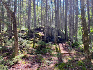 |
Pleasant surroundings throughout the trail.
|
Despite the horrendous bugs, and the heat, which really wasn't atrocious, the rest of the hike was pretty great. The trail began smooth and easy, taking us to the junction for the Rim Trail, which is populated with the waterfalls. We cruised along around 3 mph for that first stretch. Once we hit the waterfall trail, however, we slowed way down. The terrain here became an interesting combination of rocks and roots. Not a lot of intense elevation gain at any point, but it had its scrambles, climbs, and cautious ridge walks. The spurs out to some of the falls and viewpoints were even more of an adventure. It was all a perfect combination of varied terrain, keeping it fun, while not being too hard. The trail we looped back on was smoother sailing again, and we made up some time there, though not as quickly as on our way in.
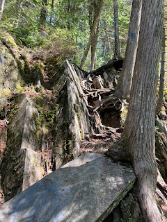 |
A typical little scramble.
|
 |
Pause for a rock hug!
|
 |
A more "normal" pic: Hawk climbs out of another scrambly spur trail.
|
The full hike is listed as being 8.7 miles. So of course I knew it would be longer, as it always is. It's NEVER as short as advertised, even when Hawk maps it out point to point. The spurs obviously would add some distance if nothing else, and most recordings I found on AllTrails landed somewhere around 9.5 miles. But mine somehow always seem to be longer. I expected we'd finish close to 10. We ended up totaling 11, so I guess that's not terribly far off my estimate, although it is quite a bit more than the suggested 8.7! 😏 I was slightly annoyed about that (because such difference could go very badly for me), but I made it through with less pain (with help from plentiful Arnica & Deep Blue) than some shorter but steeper hikes I've done. My energy level, however, was pretty crashed near the end, purely running on fumes. It definitely pushed me half a step beyond my physical limit, but I'd probably do it again. (Preferably in cooler, non-bug season.) For now though, let's try to keep most mileage in the single digits. 😉
 |
Attractive sights are fairly constant throughout the Rim. Note that there are a couple cross trails that can be used as bailout points if you're not up for the entire loop.
|
Speaking of mileage, this hike officially finishes the Spring Fling Trail Challenge for me! 🏆 75+ miles for spring hiking, just in time for the deadline. I wasn't sure if I could do it. But I managed to get 77.6 legit miles between March 1 & May 31, or if I include a few random other paths and walks I recorded and kept "in reserve" as misc. hikes, I totaled 84.6 miles! (And dammit, I had my award patch with me, right there in my pack for just this occasion, and I forgot to take a finisher photo! 🤦🏼♀️ Oh well.) Now my question is, can I keep it up and achieve the other seasonal mileage challenges?
And my other question is, how many more waterfalls can I hike to in the next 90 days?? Because I feel like this might be a logical starting point for the Waterfall Chaser Challenge! ...
On that note, here's what you've all really been waiting for - the Gulf Hagas waterfall pics! Along with some of the other awesome sights on this hike.
 |
I think this might have been part of Stairs Falls.
|
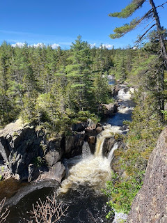 |
Billings Falls
|
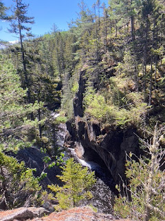 |
Lots of really interesting rock formations.
|
 |
| Gulf Hagas is often called "the Grand Canyon of Maine" - rightfully so. |
|
 |
Long way down. Oh wait, this isn't the viewpoint... the spur actually ends on that rock point there!
|
 |
Obviously I had to do it! Carefully creeping out for some photos...
|
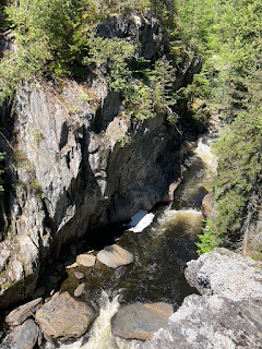 |
A view from the point.
|
 |
Looking back at Hawk, where we momentarily thought the official viewpoint was.
|
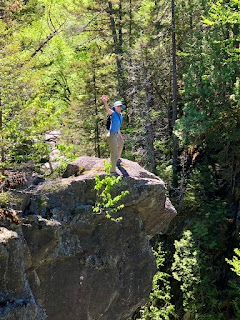 |
| "You telling me to be careful is not going to make me more careful." But don't worry, I was! |
 |
Hawk filters and refills our water bottles at the cascading stream.
|
 |
Basin below the largest waterfall in the Gulf.
|
 |
A peek at the grand falls, saving the "best" for last. Hawk found his way down the spur, and offers some perspective of size.
|
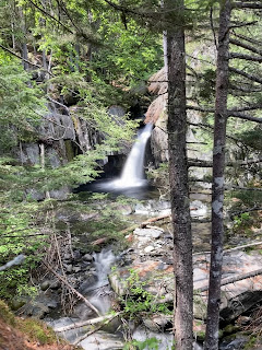 |
This is Screw Auger Falls... a very popular name, it seems!
|
Hike 26. 5/29 Gulf Hagas Rim Trail loop, 11 mi, 5:50 hrs, 1099 ft.


No comments:
Post a Comment